KMS (Kennedy Meadow South)
So we reached Kennedy Meadows. It’s a small place with a population of about 200 people. I don’t really know what they do in the winter, but the town mostly survives on hiker packages and the steady flow of Pacific Crest Trail hikers passing through.
For the PCT, this is the stopping point. Everyone stops here. We got there on May 7, and normally people don’t enter the Sierra until around June 15. There was still snow, and we would’ve been some of the first people heading north that season.
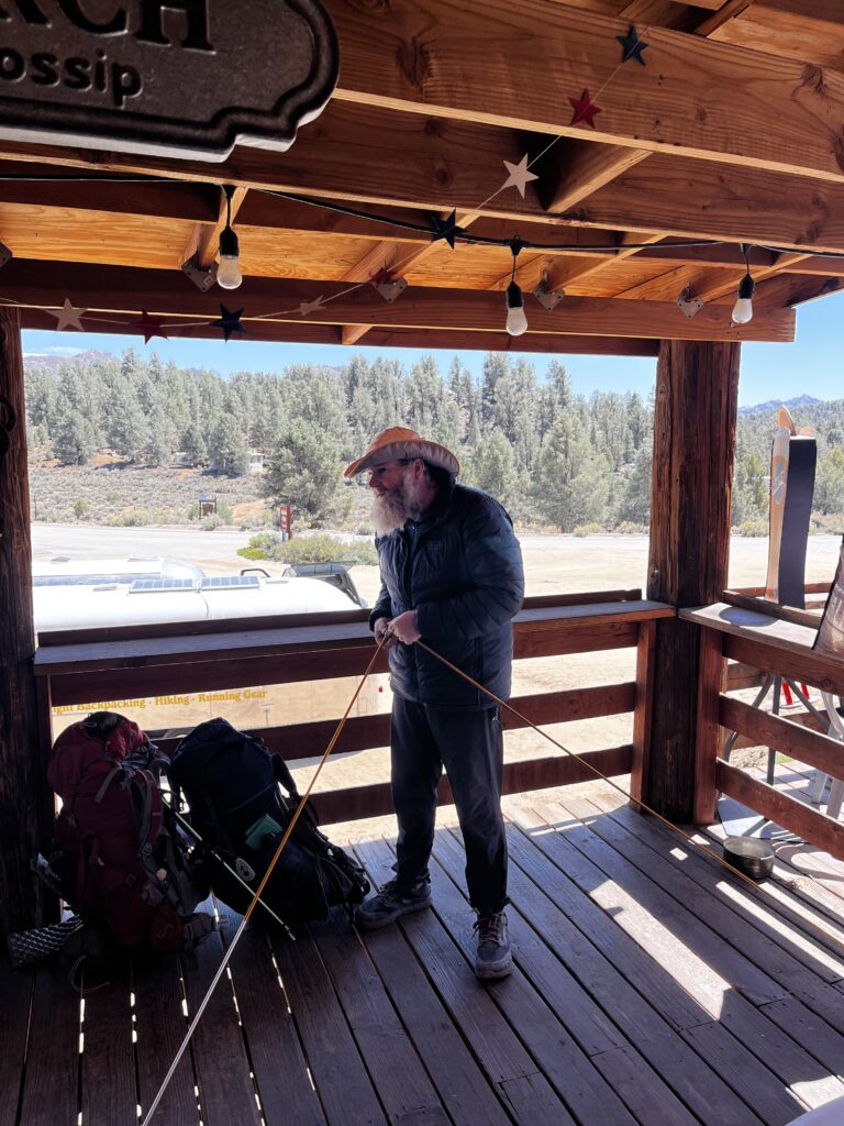
So we thought: why rush it? Instead, we stopped to celebrate. Pitched our tents in the back of a General Store, chilled for 2 days, and enjoyed the rare luxury of doing absolutely nothing—because after Kennedy Meadows, things stop being relaxed very quickly.
Oh, by the way, when you enter Kennedy Meadows South, you go to the general store at the end camp. The people there see hikers coming in and start clapping. It’s a simple, supportive way to celebrate anyone who’s made it through the first stretch—the desert. It’s a small gesture, but the trail community feels real here. Uplifting for both sides.
Entering the Sierra Nevada means you need a bear canister, because there are a lot of bears. Naturally, I didn’t want to buy one, because I’m cheap. Instead, I found this guy, Doug, in a PCT Facebook group. Apparently, he gives out and rents bear canisters to PCT hikers—for free. Trail magic, but logistical. He shipped one to me and even threw in a few extra gifts inside, which immediately made me feel slightly guilty about all the jokes I’d made about bears being overhyped.
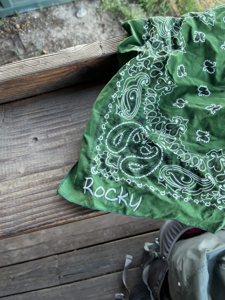
It turns out he didn’t just ship the bear canister. He filled it with Asahi Japanese beer, ibuprofen, snacks, and a beautiful green bandana. His wife embroidered Rocky on it. I couldn’t believe it. This guy has never even met me. We just exchanged a few messages on Facebook. It was one of those moments that reminds you how unexpectedly kind people can be—and how much they’re willing to help a complete stranger on the trail.
And on top of that, I finally got the replacement part for my tent. Some Canadian guy—whose name I sadly don’t remember—helped make it happen. If you ever read this, or someone tells you about it: thank you. I really appreciate it. People were just helping me out left and right. No expectations. This trail community is kind of sick.
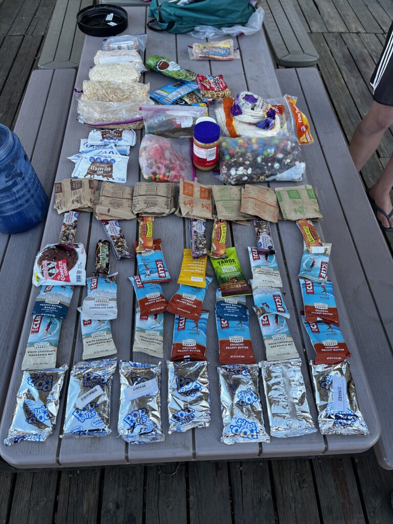
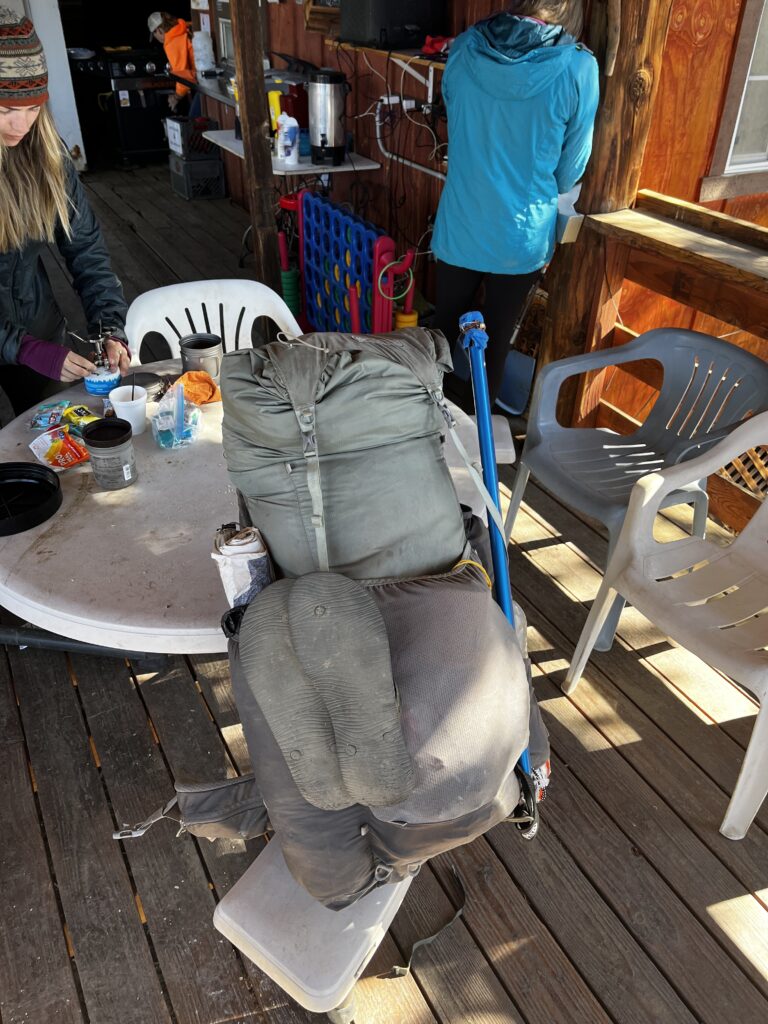
With the bear canister and 6 days’ worth of food for the next stretch, my pack started looking really, really huge—and heavy at the same time. But nobody said it was going to be easy. Nobody said anything. I signed up for this because I was bored of living a “normal” life, I guess.
Food
Uh, so what was I eating? My breakfast was usually Pop-Tarts, and maybe some oats. I would just have them with cold water. Then throughout the day, I would eat different bars—Clif bars, cookies, granola bars—anything I could get my hands on. For lunch, I would do peanut butter or tuna tortilla wraps, with a lot of trail mix on the side and some gummies for sweetness. I had some breakfast essentials too, which you just pour, mix with water, and drink. For dinners, I would do all kinds of gnocchi or pasta sides. I’d add extra cheese and sauces for more calories, and I even had an extra bottle of olive oil that I would just crash. I was probably eating around 4,000–4,500 calories on this stretch. And yeah, all that food weighs a lot.
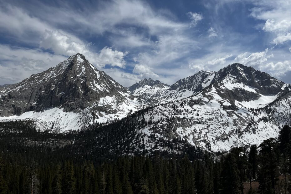
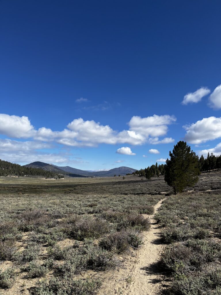
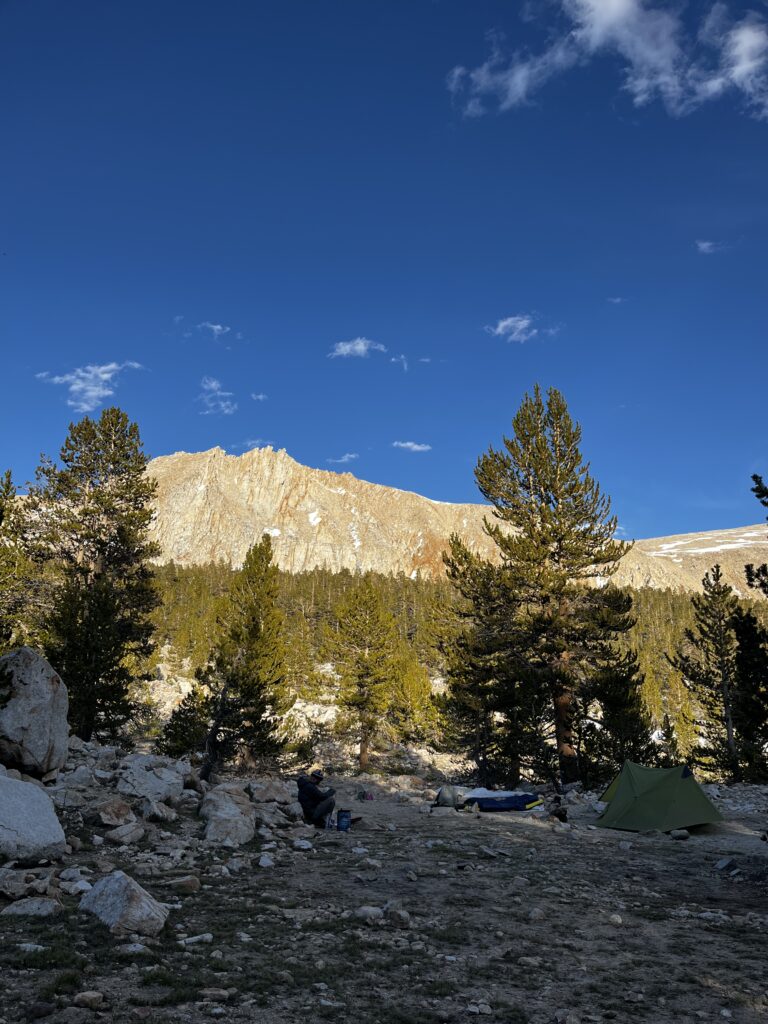
The start of Sierra Nevada
After a few days of resting and fixing my tent, we finally headed out for the Sierra Nevada. Some people had left half a day earlier, and as you remember from the previous blogs, by now we had a small trail family – also called a Tramily for the people we were hiking with.
The first days, I was just thinking, all right, this is the big dogs’ game now. It’s gonna be serious, it’s gonna be hard, and we’re doing it early in the season. At the same time, I was excited to be where I was, and slowly but surely we headed into the mountains and the snow. It was my first experience in snow ever.
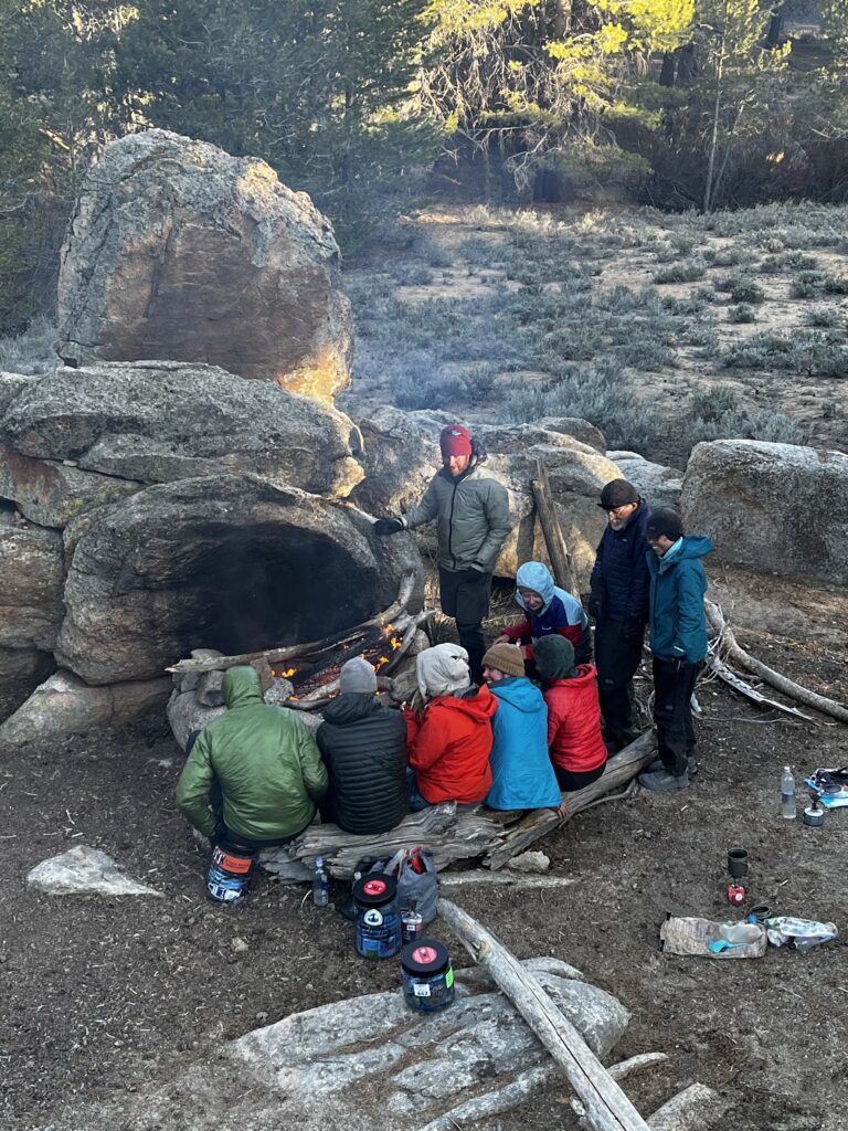
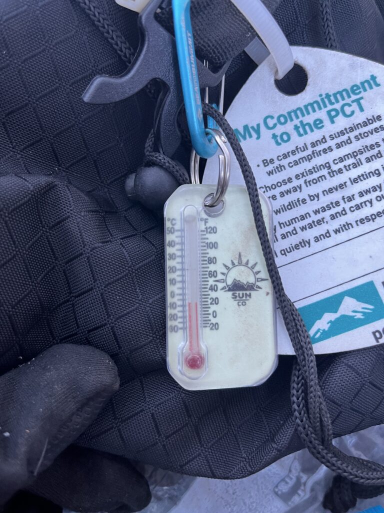
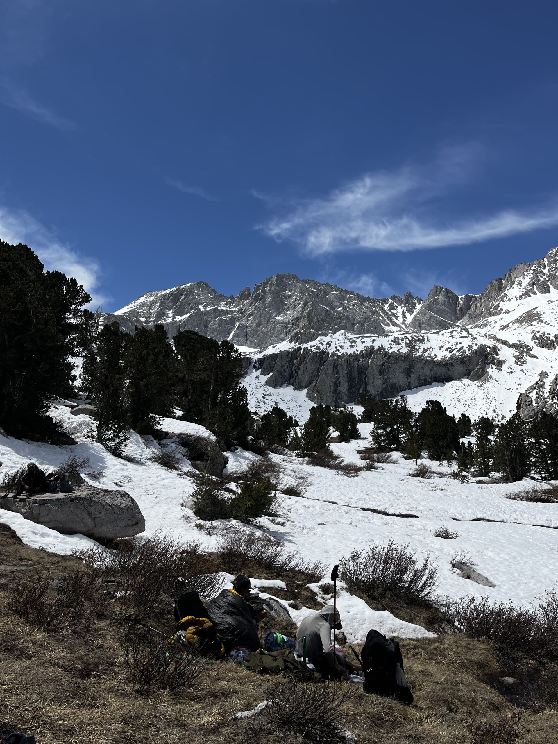
Well, I’ve shown you the picture of that food stretch and the food we were carrying—that was 6 days. Apparently, we hit a cold stretch. The first couple of days, nights were like negative 5 Celsius / 20 F, and during the day it was just above freezing. So we were thinking, what should we do in the evenings? Chill by the bonfire.
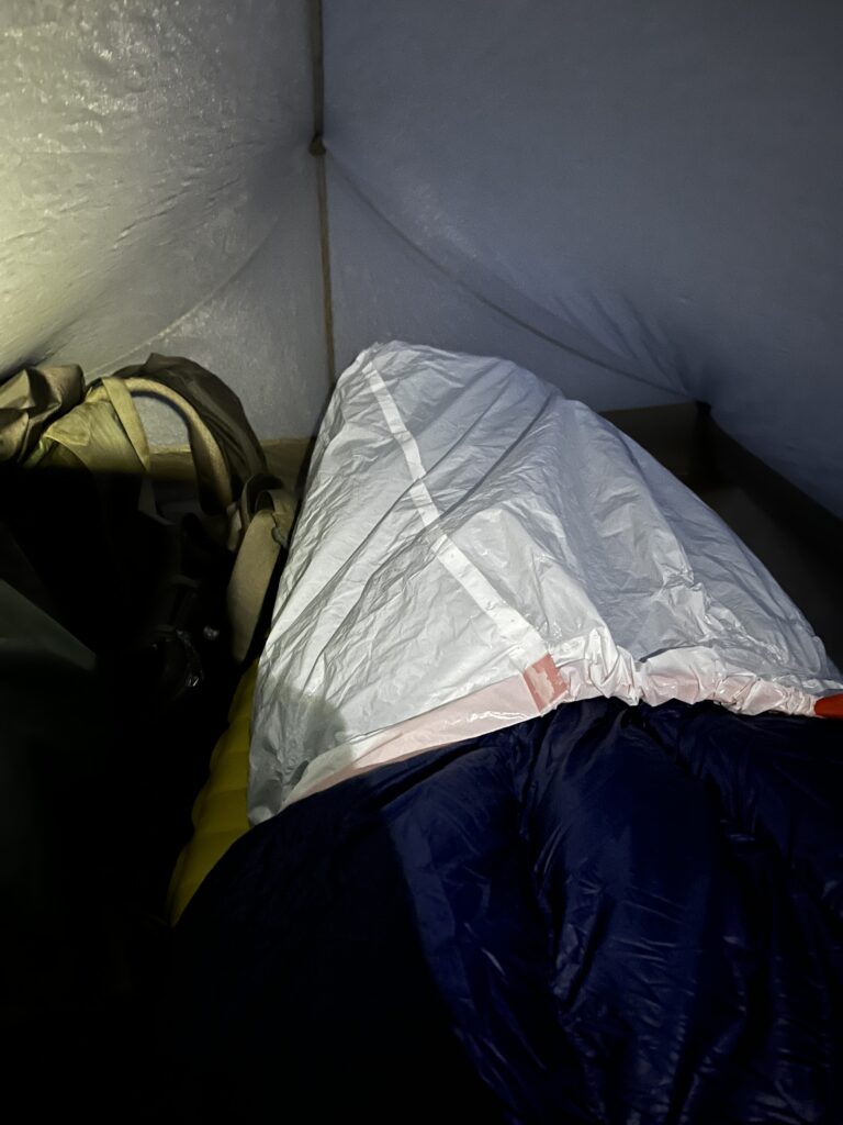
Then the next night it dropped to around negative 10 C / 14 F, I had to improvise—pulled a trash bag over my sleeping bag to keep warm. Didn’t really help, don’t know why I did it. I managed to survive, but it was really cold.
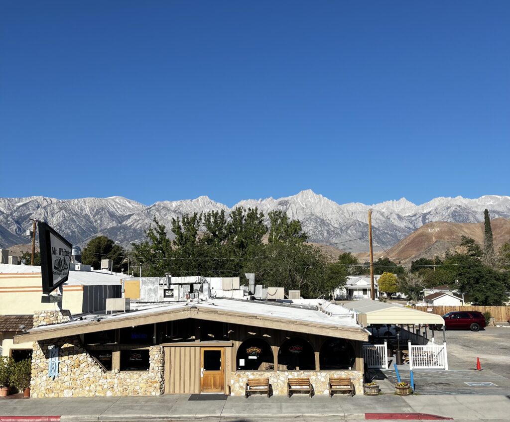
A few of our friends were ahead of us, and they left a note saying we should stop in Lone Pine and wait a day for the weather to get better. Otherwise, we wouldn’t be able to hike Mount Whitney, which is a side quest on the Pacific Crest Trail. So that’s what we did.
It’s funny, because I was carrying all that food, and then I realized – we only really needed like three days’ worth. Now we had an extra descent and would have to climb back up again.
New plan
So we were trying to come up with a new plan in Lone Pine. Boogie—he had hiked the Appalachian Trail and the Colorado Trail—was kind of our guide/leader. None of us had much experience before this. He came up with a plan: take it easy, slow. We agreed. Hike 10, 15, 16, 20 miles per day, do a pass every day, camp low, and make sure we’re not stuck on snow.
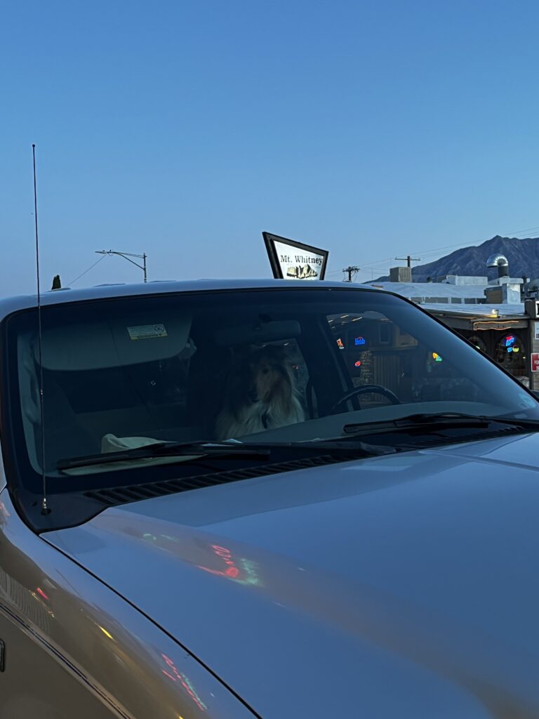
Chilling in Lone Pine was amazing too. Great views, and I even saw a dog behind the steering wheel of a car.
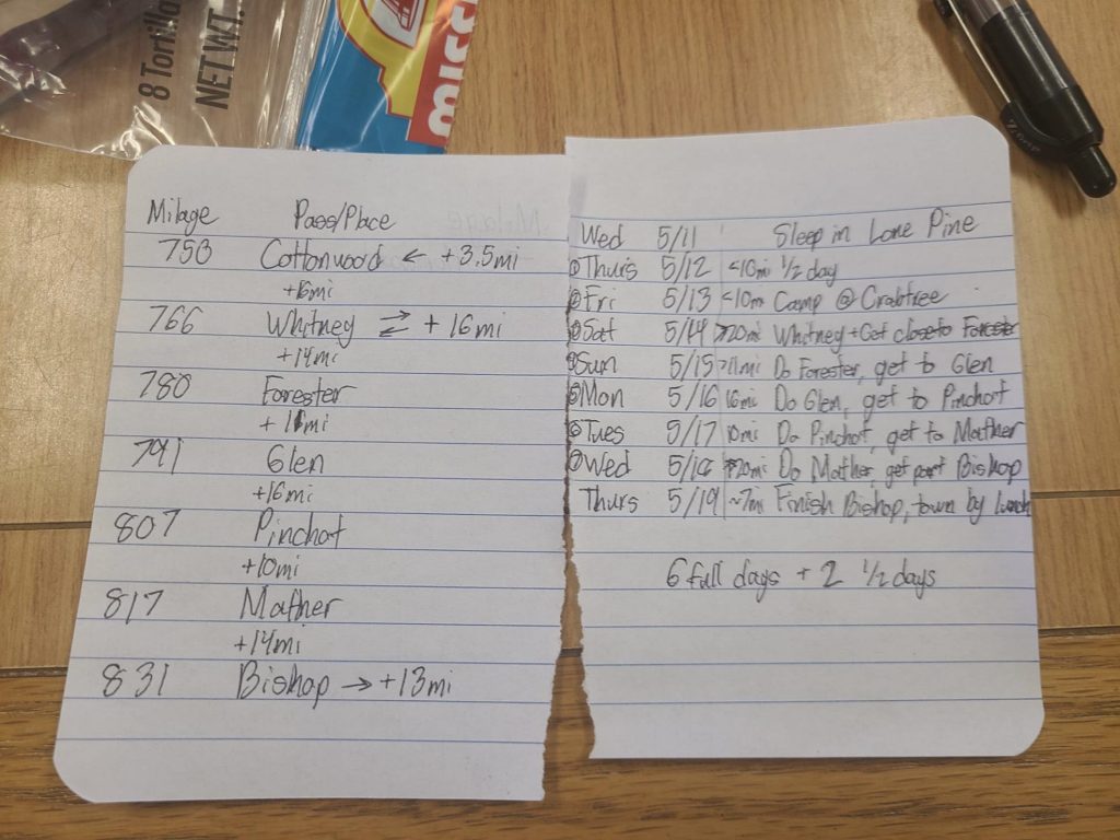
I know it is surprising to see a handwritten plan
Mount Whitney
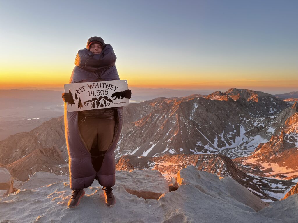
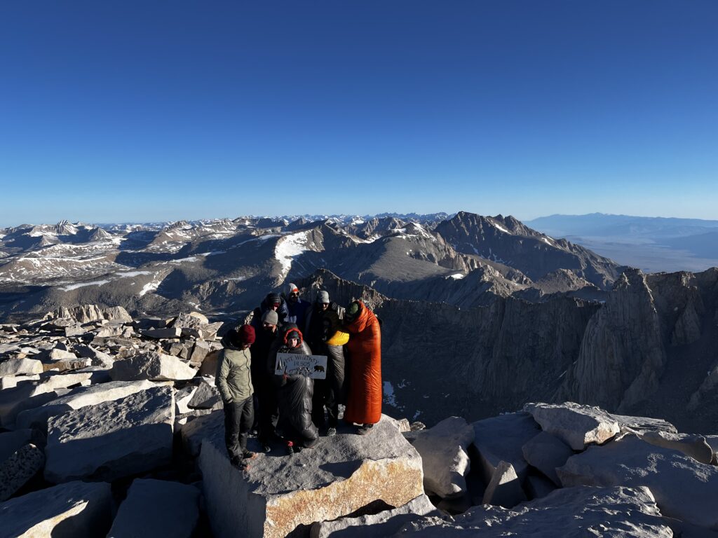
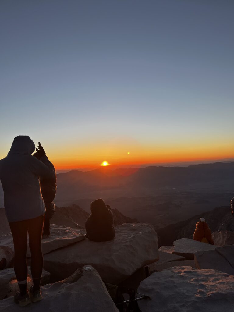
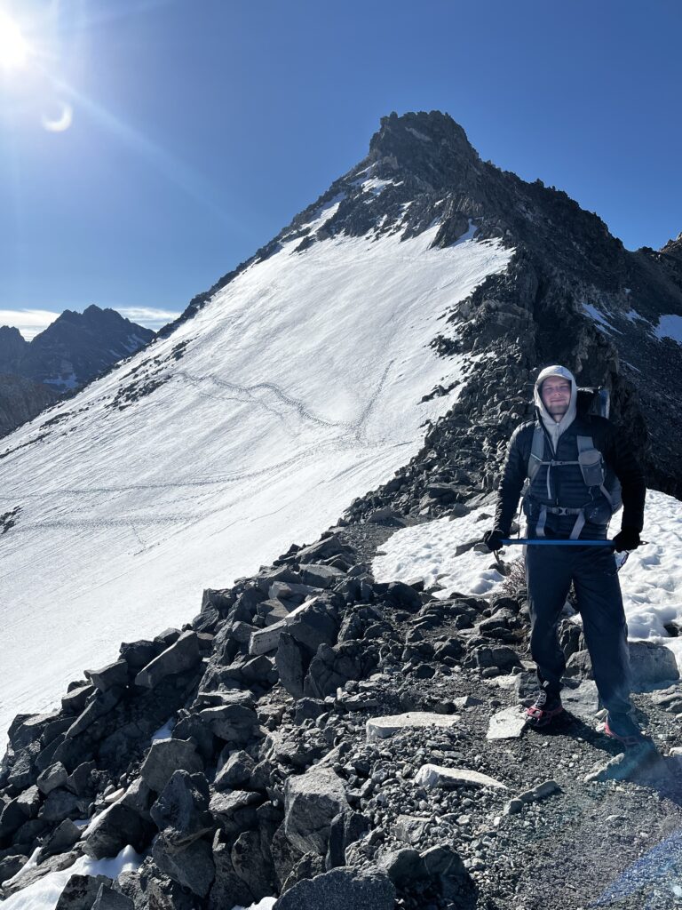
So Mount Whitney is technically not on the PCT. It’s a 1-day side hike, and of course, if you want to summit for sunrise, you start at midnight. That means the next day gets really, really hard. And of course, that’s what we wanted to do.
So we headed out to do Mount Whitney. Honestly, it was one of the craziest experiences I’d had up to that point. I couldn’t really fall asleep because I was so excited, and I knew I’d be waking up around 12:30 at night since we had to start hiking at about 1 a.m. It was a full moon, so we hiked most of the time without headlamps, just slowly going up and up and up. I was a little bit worried about the elevation. I could feel something, and I kept thinking about it – Mount Whitney is what, around 14,500 feet, whatever that is in meters.
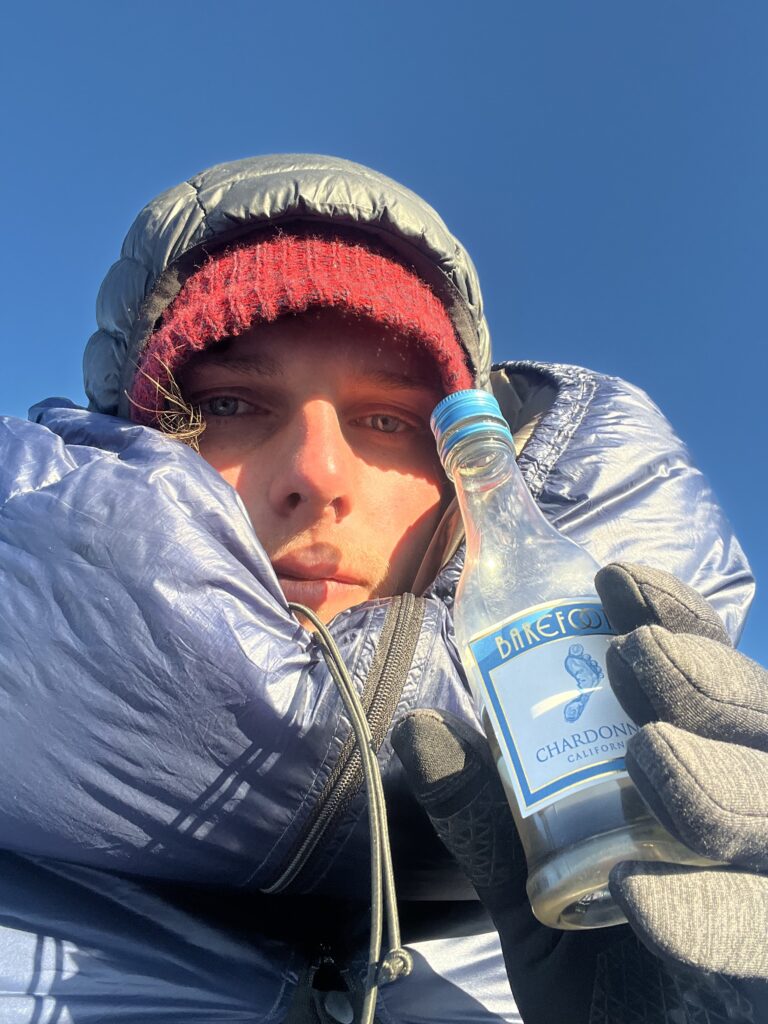
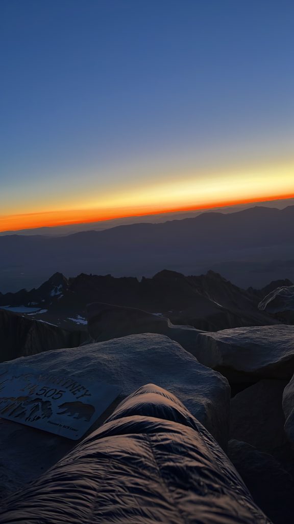
But we just kept going. And yeah, it was hard. Hiking at around 4.5 kilometers of elevation is not easy. But the views were incredible. So here we go – some pictures and videos from the very top of Mount Whitney, the highest peak in the continental U.S., the lower 48.
Some additional facts as well. The campsite we were staying at—by the way, if you have a PCT permit, you can just show up, hike in, and stay at a campsite without booking anything in advance, which is amazing. Again, it just shows how powerful the PCT permit is. Hell yeah.
There are also a ton of bears in that area, mostly because people are stupid and leave their food out. There’s a significant overlap between the smartest bear and the dumbest person. Because of that, you’re supposed to leave your tent open, so if any rodents or bears show up, they can see, get in, get out. I doubt a bear would actually crawl into your tent, but at least they won’t destroy your gear. And yeah, there was a guy who was really struggling with altitude sickness and had to be helicoptered out of the area.
The Sierra Squeeze
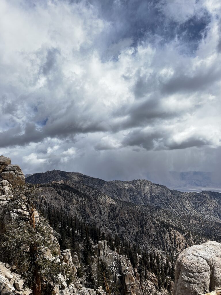
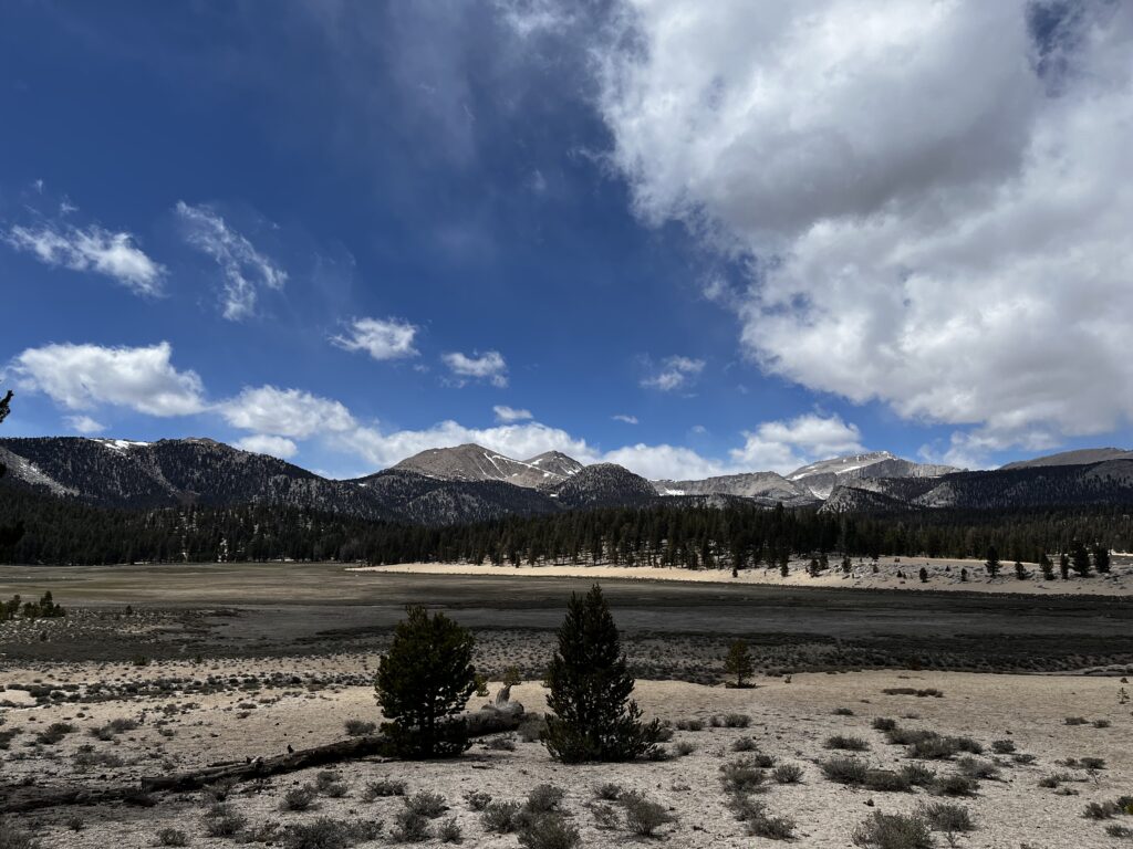
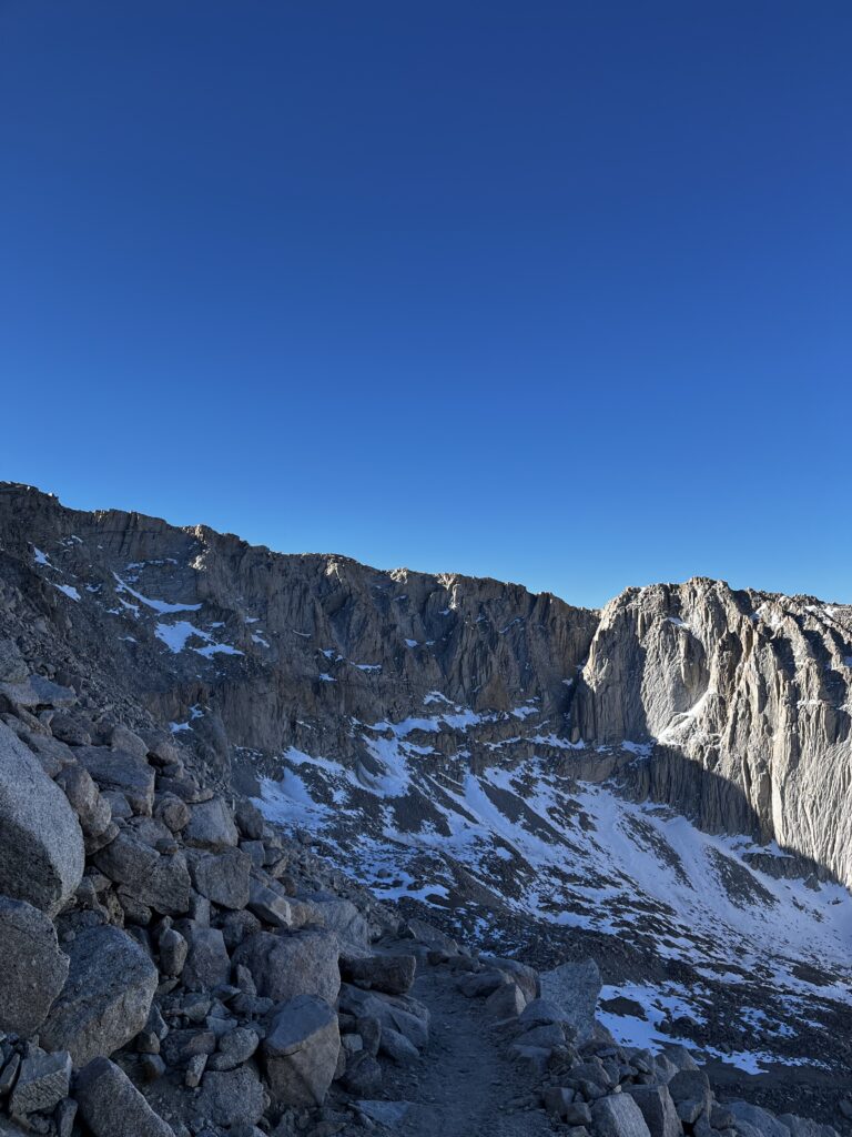
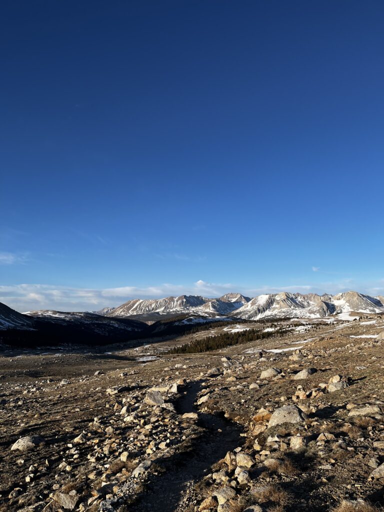
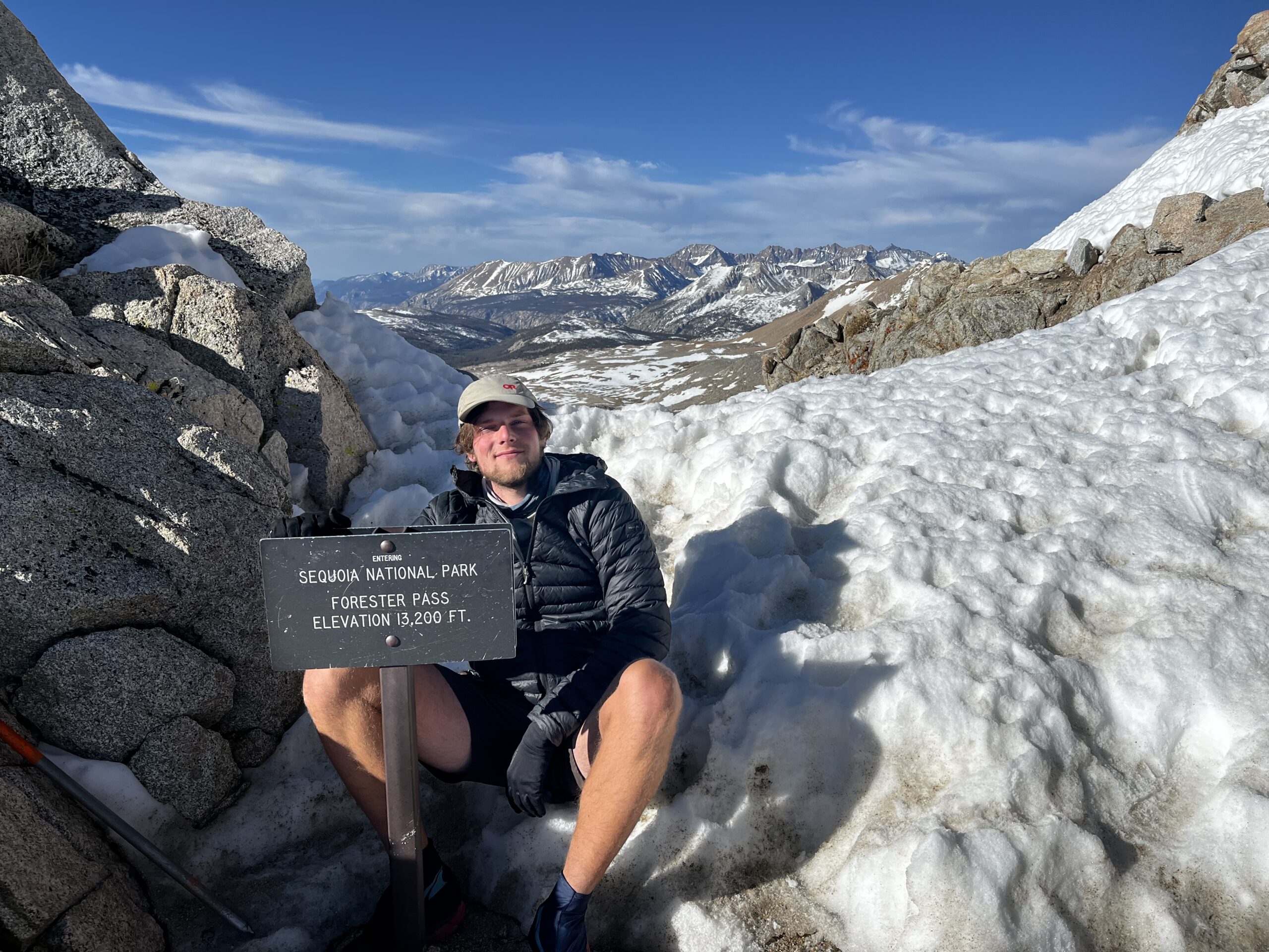
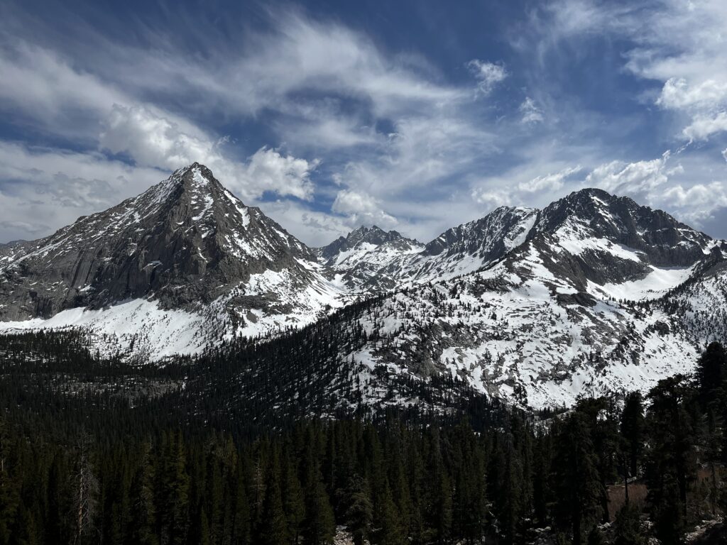
After Mount Whitney, the highest pass on the PCT is the Forester Pass and sits at about 13,200 feet – basically 4 kilometers up. Honestly, after bagging Whitney, everything else started to feel “easy.” We stopped worrying about the climb and finally started seeing the real beauty of the Sierra. Every day looked different, which is a weird thing to say about a bunch of rocks and snow, but it’s the truth. But “easy” hiking in the Sierra requires a specific kind of tactical math.
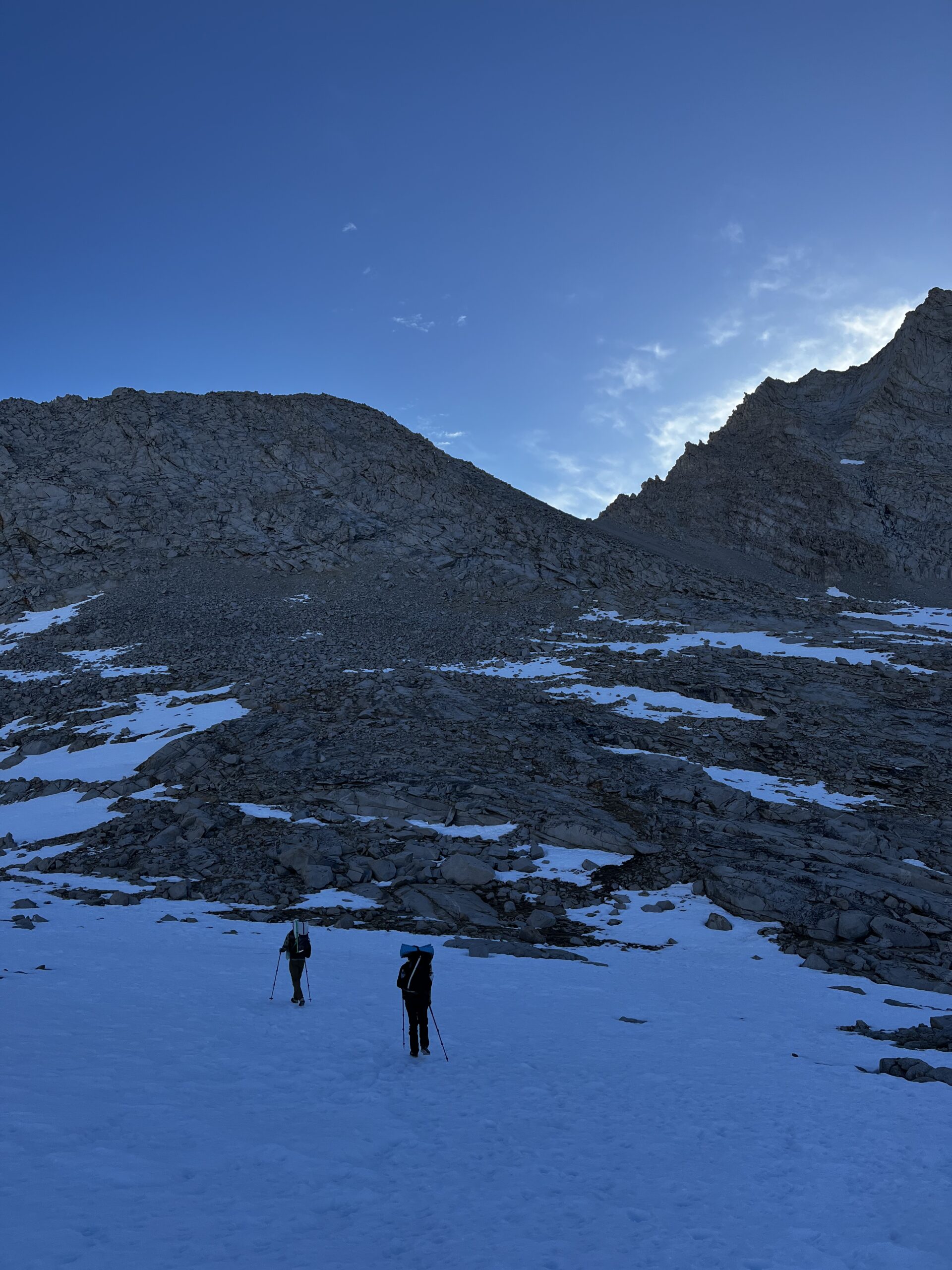
The Posthole Clock: The mission was simple, beat the sun and hit the pass early (Forester being the first one). We’d wake up at 4:30 or 5:00 a.m. to hit the passes by 8:30 at the latest. The goal was to get over the top and into the valley while the snow was still frozen solid. Once that sun hits the snow above the tree line, everything turns to mush. It starts with a little sink, then you’re ankle-deep, and suddenly you’re postholing knee-deep into a freezing slush trap. Every step becomes a struggle. Our rule was to get as close to the next pass as possible by the end of the day, but never start a climb once the snow had softened.
It makes more sense to “slide down”
Glen Pass
Fear and excitement. Those are the two words I wrote in my journal to describe the day we crossed Glen Pass. There’s a good reason for that.
Even though Glen Pass is lower than Forester, it’s a completely different animal. Forester—despite being the highest—is actually the easiest. Glen Pass was the first time we really had to use our heads. The downhill was a mess of rocks and steep snow; one wrong move and you’re sliding. And if you slip, you better hope your self-arrest muscle memory kicks in.
I had an ice axe, and I’d “learned” how to use it. I practiced a few times on low-stakes slopes, but in reality? When you’re sliding down a 20–40% slope, I’m not sure how fast you can actually make that work. I was being extra cautious, placing every step like my life depended on it and following random footsteps in the snow. I didn’t even know where they led—we weren’t following a trail anymore. We were just making one.
I was wearing dance pants instead of rain pants, because they were $18 instead of proper rain pants that cost $80–100. Just one more confirmation of my dirtbag tendencies. What I didn’t know at the time was that they’re insanely slippery on snow. Ignorance is bliss sometimes.
Our descent route
Me, happily chilling after descending and waiting for my amigos
So what else were we doing, and how were we spending our days? Since we managed to get most of the work done in the first part of the day, things slowed down a lot. Sometimes we were moving at 1 mile an hour, maybe 1.5. Even doing 15–20 miles could take 7–8 hours, sometimes even 10, depending on the terrain. We were never really rushing, just taking our time.
So yeah, we were jumping into lakes. Even though there was snow all around us, it was actually pretty warm during the day—around 15°C, or 58°F. It felt great. And that’s what it looked like.
Or sometimes we would just walk together and talk shit, enjoying the time, sharing stories, and appreciating nature.