July 4th
I left California after 99 days on trail, and now I’m finally in Oregon. Hello, no sales tax. Technically, it should be cheaper here, but we’ll see how that actually plays out. As I crossed into Oregon, I didn’t have many expectations. I just knew it’s one of the flattest sections, so realistically, it should be easier than what I’d just been through.
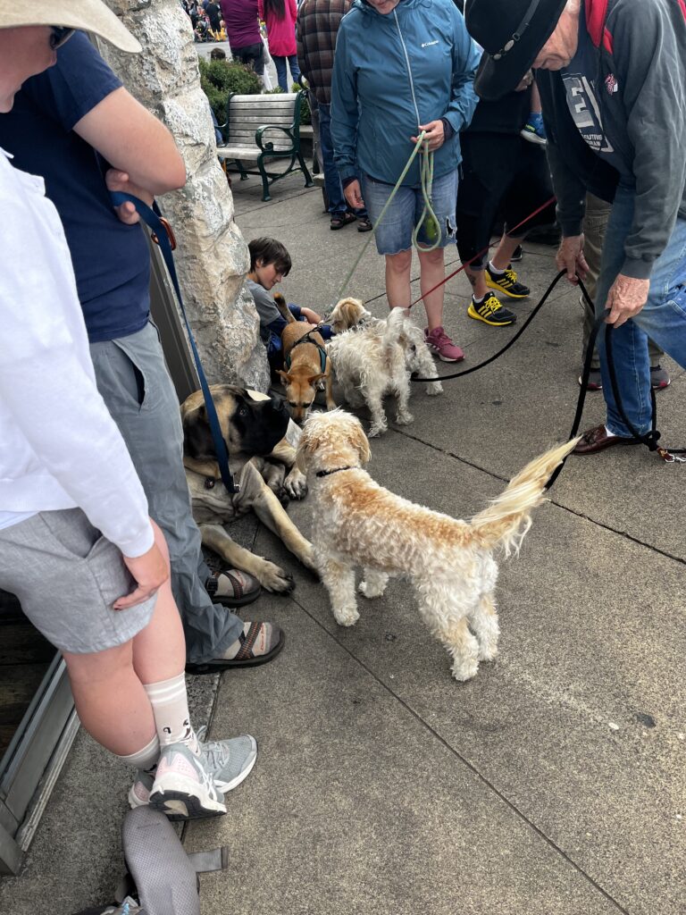
We arrived in Ashland on July 4th, and honestly, it was amazing. It was my 3rd Fourth of July in the U.S. I feel like I’m always there for it. Watching the parade felt really nice. Ashland is a relatively small city but bigger than the ones we’d been passing through. The parade had lots of dogs, people were super friendly, and it seemed like quite a few hikers had timed their arrival to catch the festivities too.
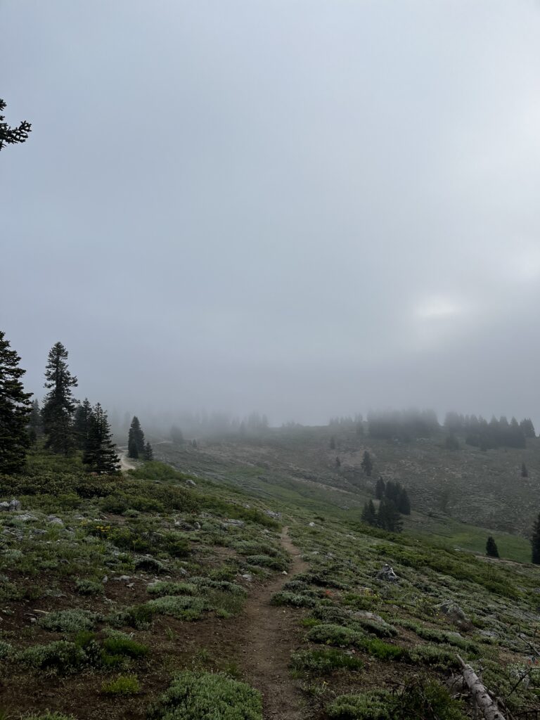
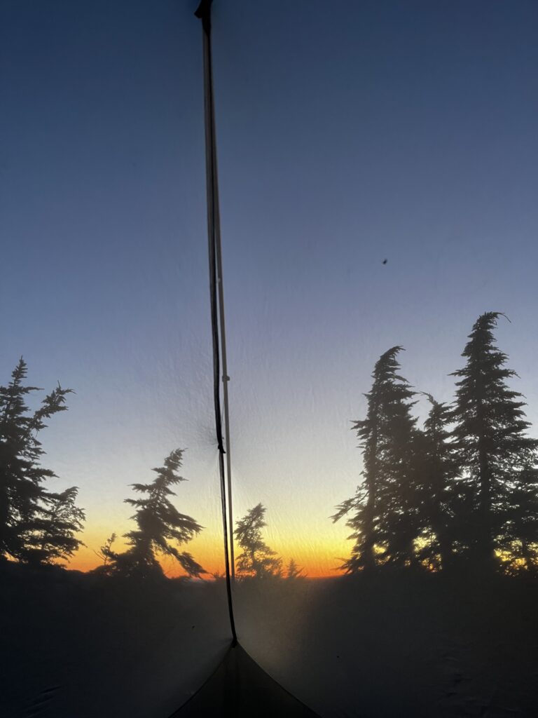
July 4th started off misty
Random
Oregon had this all-you-can-eat Indian buffet, and for hikers, a stop like that is always a must. It just makes sense. The strategy? Arrive as hungry as possible so you can eat as much as you can. That was our plan. And then, someone came in with these tiny little hands.
We hadn’t talked about people’s generosity in a while, but during the parade we met a lady named Jeanne. She started chatting with us and gave us her business card, saying if we ever needed help, she could. And I took her up on it. After finishing my resupply in town, I was doing a “hero” day, meaning hiking into town, getting everything I needed, and leaving the same day, since towns tend to pull you in and slow you down. Jeanne actually drove me back to the trail where I had left off that morning. Hats off to her, she was amazing.
Big dog energy
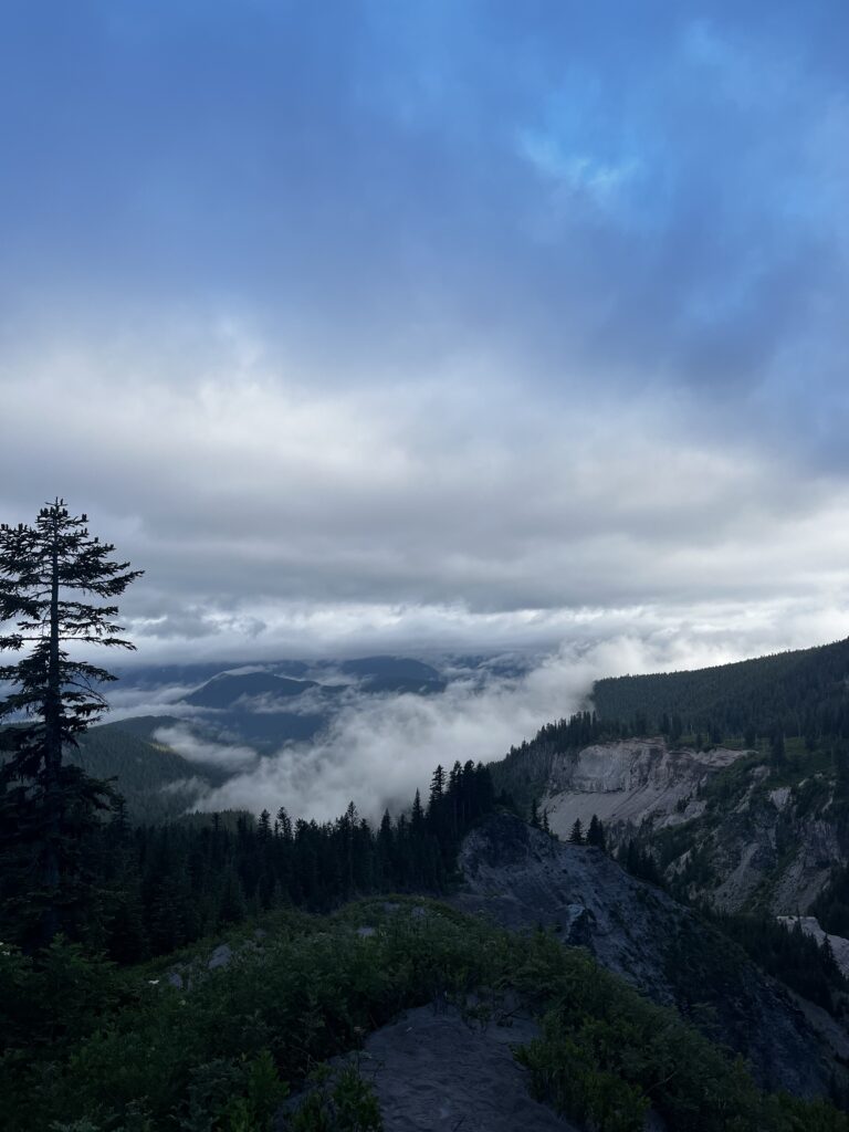
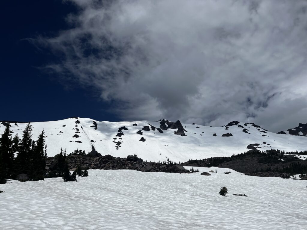
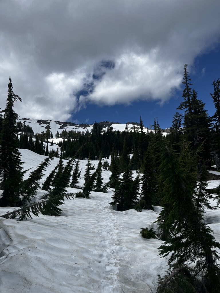
The first days in Oregon
The first days in Oregon were kind of interesting, I didn’t fully know what to expect. It was misty, foggy, and then we started running into snow. I had no idea what I was getting myself into, or that this would turn out to be some of the mentally hardest days yet. Soon enough, we’d find out why.
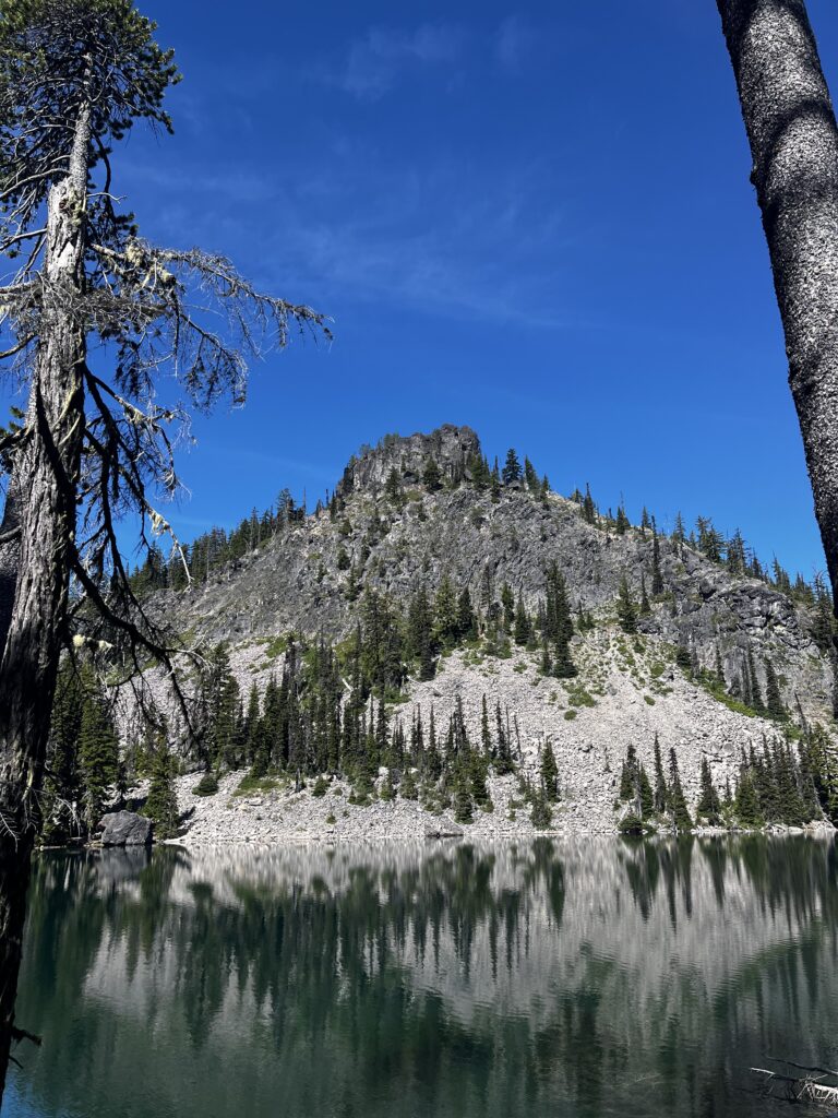
Got this nice camping spot
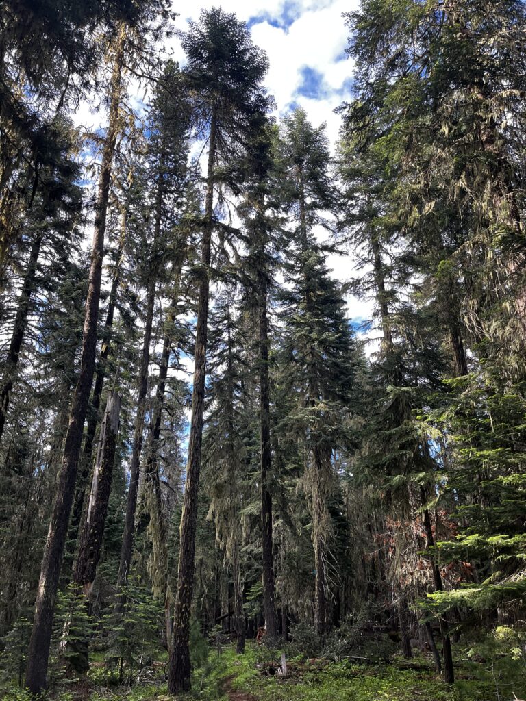
Some different looking trees, nice change of scenery
So in Oregon, on maybe my second or third day, it was pretty wet. I realized that if I pushed hard, I could make it to a cabin I’d read about in the comments. My plan was simple: if it rained again, I could just sleep in the cabin to stay dry and save what little dry gear I had left.
The cabin had a roof, so I managed to dry everything inside, which was a huge relief. One catch, though—it had rats. You had to store your food carefully and hide it at night and in the morning. Still, I’d say that’s a small price to pay for having all your stuff dry.
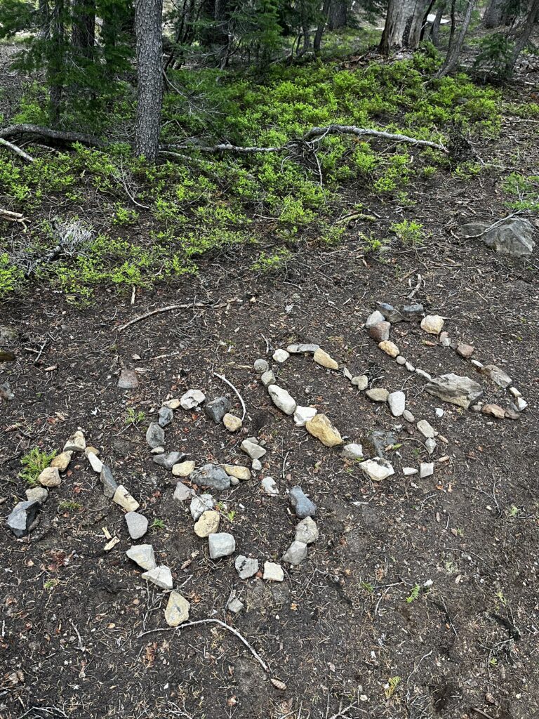
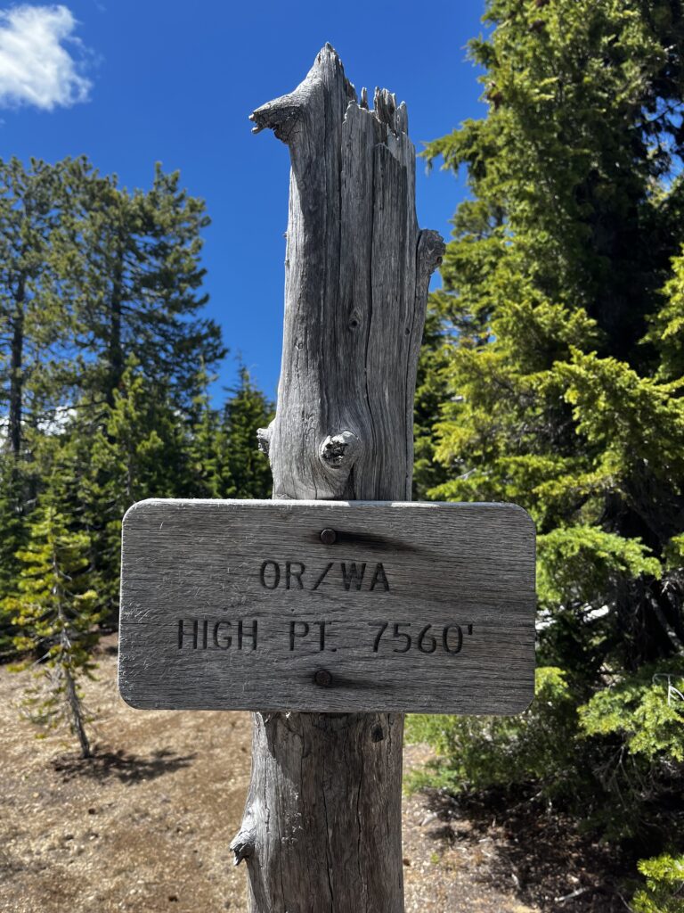
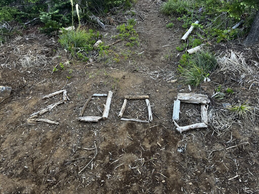
1800 miles
I came across a sign on a rock marking 1,800 miles. I took a picture, but in reality, it didn’t mean much. Stepping back, I realized nobody really cares what I’m doing except me. Sure, 1,800 miles is impressive, but if I had stopped there, it would have felt like an accomplishment and at the same time like unfinished business. So yeah, it’s just a picture, I paused for a moment, but it didn’t change anything.
Online (on blogs, vlogs, or Instagram reels) you often see people celebrating milestones with big emotions. But in reality, when you actually reach that mountain or checkpoint, you’re usually so exhausted that all you do is acknowledge it and keep moving. Most of what you see online is just… staged. Sorry to break it to you.
You might’ve noticed that the start of Oregon felt pretty blunt—dry, flat, and honestly not that interesting compared to earlier sections. And yeah, that just happens. Sometimes you get three, five, even more days of boring hiking. We had the same thing in the burned sections of NorCal.
The beginning of Oregon was one of those stretches where you expect something to happen… and it just doesn’t. You’re waiting for it to click, and instead you’re left managing your expectations. That’s part of the trail too. So yeah, just to be real about it: it’s not all roses like people often paint it online. It can be boring as fuck. But boring doesn’t create viral moments or dramatic clips, so most people don’t post that part.
Expect the unexpected
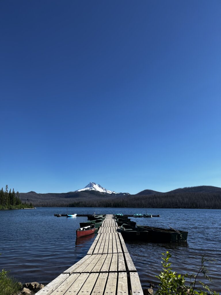
Crater Lake is one of those places that’s not even really hidden – it’s just that the original PCT route doesn’t go there. It’s actually one of the very few alternates that almost everyone agrees is worth taking, because it gives you something better than what the official trail offers at that point. So yeah, I took the alternate. And honestly, it was spectacular.
And once again, the trail community came through. In stretches where water access is scarce, people leave water caches. It’s such a simple thing, but it makes a huge difference. It takes so much pressure off your mind and eases the constant worry about where you’re going to get your next water. Every time I saw one, it just reminded me how generous and thoughtful the PCT community really is.
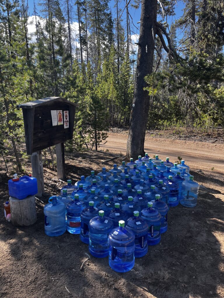
A massive water cache
So basically, I started the PCT earlier than most people. That meant dealing with a lot of snow in the Sierras, which was honestly a lot of fun. But by the time I reached Oregon in July, getting close to mid-July, I really wasn’t expecting to see snow again at 6,000–7,000 feet.
What I didn’t fully account for was that Oregon had a very late snow year. If I’m not mistaken, a lot of that snow fell in April or May and never really had a proper chance to melt. When I came through, there were these mini heat waves, and all that snow started melting at once. The result was standing water everywhere and mosquitoes. Lots of them. That pretty much summed up my Oregon experience at that point.
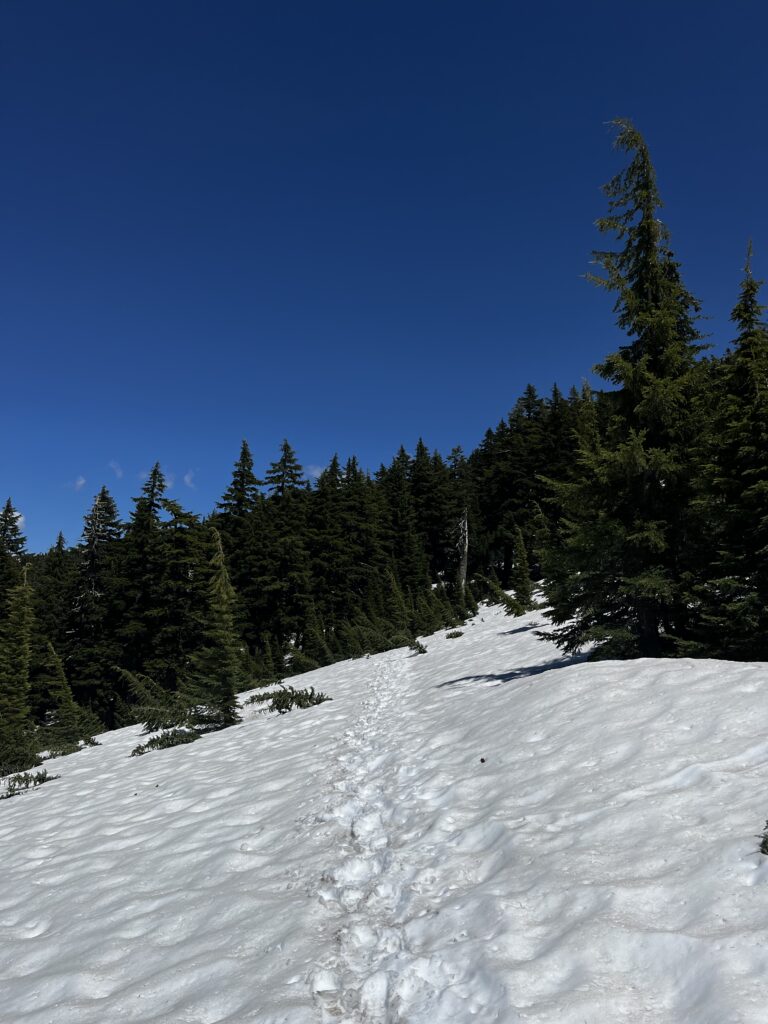
Brutality of Oregon
In reality, there was a lot more snow walking than I’d expected. It wasn’t snow all day, but having to navigate it for 2, 3, or 4 hours meant every step required significantly more effort. Even without big climbs, moving on snow drains your battery in a completely different way.
And when there wasn’t snow, there were the mosquitoes. Thousands of them. Dealing with them basically meant you had to keep moving, and moving fast. You had to maintain at least 3.5 mph, because the second you slowed down, they were all over you. You could feel them landing on your shoulders every 10–15 seconds, searching for a gap in your clothes. Sometimes the only option was to push closer to 4 mph (6.4 km/h) which is an aggressive pace when you’re carrying a backpack through variable terrain, day after day.
Stopping for a break was an entire operation. If you wanted to sit down for even five minutes, you had to suit up in rain pants, a rain jacket, gloves, and a head net. Otherwise, you’d just get destroyed. That was the trade-off: either you keep the “Corporate Weapon” pace up just to outrun the swarm, or you suffocate in waterproof gear just to take a breath.
By the time you set up your tent and get in, in that 15 second span while you get in, there are probably 10 mosquitoes in your tent already. If you’re taking a shit outside, you have to apply DEET on your butt so it doesn’t get bitten, or you’re taking a shit and wiping your ass with one hand and waving at the mosquitoes with the other hand. That’s just the reality of the trail, baby. At least I didn’t have any fires in Oregon, so that’s that.
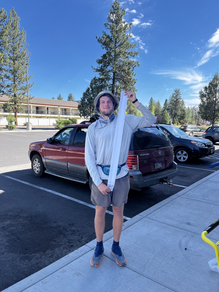
Oh yeah, want to hear something else that’s fun? Because I was sweating so much and wearing shorts that were probably 1 size too small for me, even though I was losing weight, apparently a Patagonia’s size L still doesn’t work when you’re 6’4″ and around 190 lbs. There was a lot of rubbing around my waist, and that’s the result. I’ve basically been walking like this for the last 2 months.
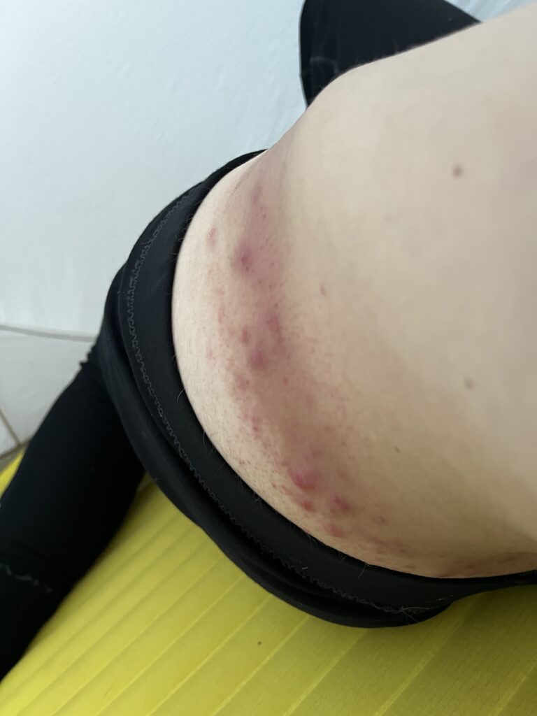
This took over 2 months to heal after the trail
During this stage of the hike, I was exhausted, mentally and physically. After leaving Ashland on July 4th, I’d been averaging around 58 km / 36m a day for 5 straight days. Even though Oregon is supposed to be flatter, the snow sections made everything harder than expected. At that point, I knew I needed a mental reset and at least half a day off. There was a place called Shelter Cove, a campground where you can send a package, chill for a bit, and resupply at a small general store. That became my goal. But to get there, I still had to push through one more tough day, battling exhaustion and fighting off mosquitoes the entire way.
To make things even better, there was another half day of walking on snow. It was beautiful, don’t get me wrong, but at that point my mind was already set on one thing: sitting down, drinking a Coke, and reevaluating my strategy. I knew I was ahead of schedule, so maybe it was time to adjust how I was approaching the rest of the trail.
It’s simple. Basically, you are either on snow which means every step you take, you are to some extent post-holing or you are not in the snow but because there is so much meltwater nearby, you are constantly surrounded by mosquitoes. Basically, you are losing all the time. That really tests your grit, your perseverance, and your readiness for this trail. It is a mental game as much as a physical.
Day 105 of hiking the PCT
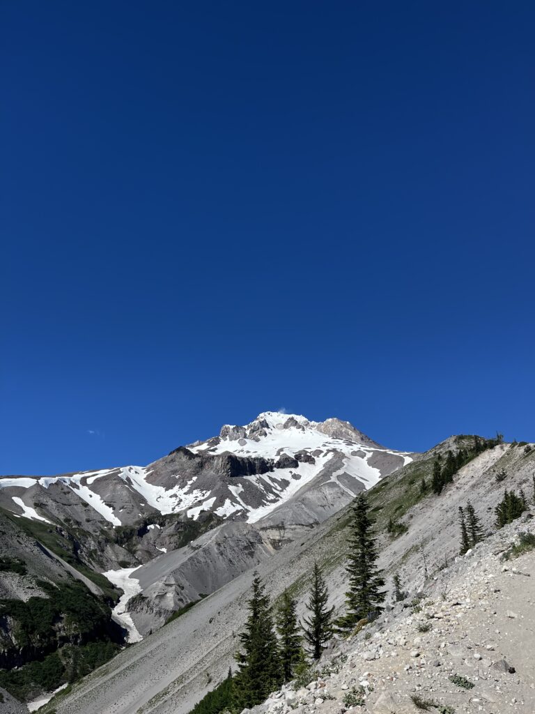
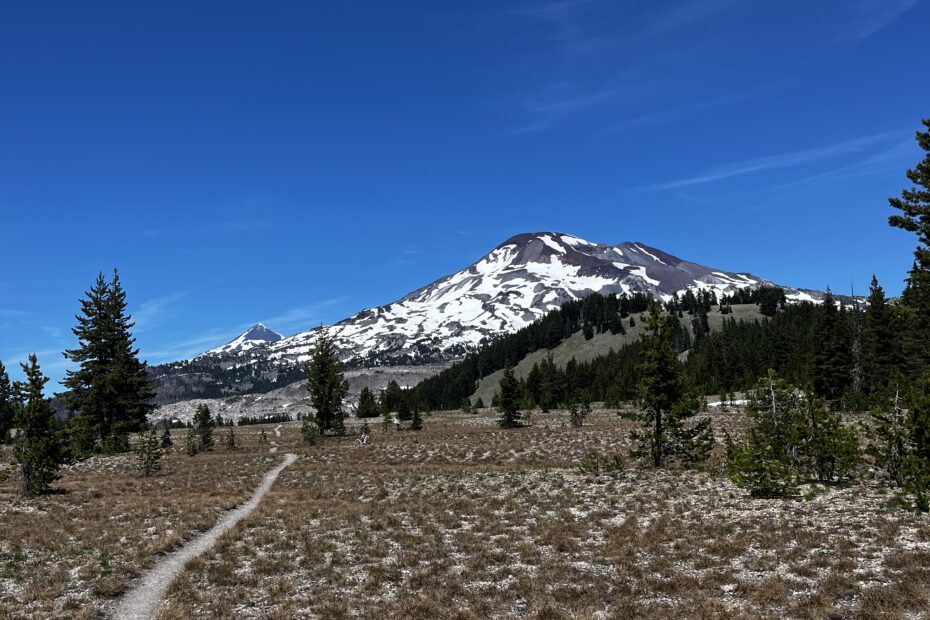
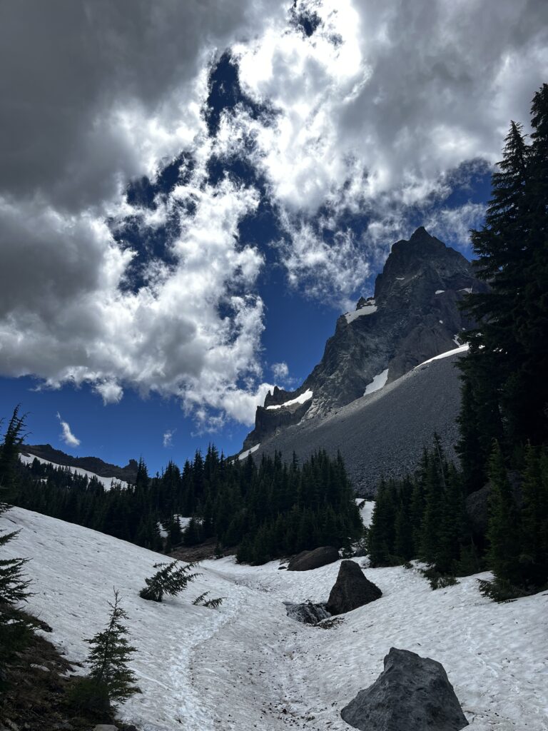
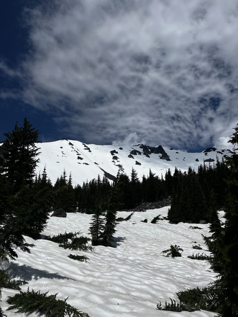
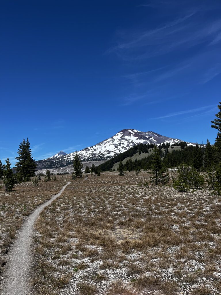
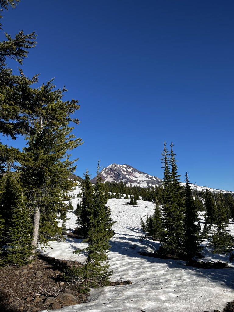
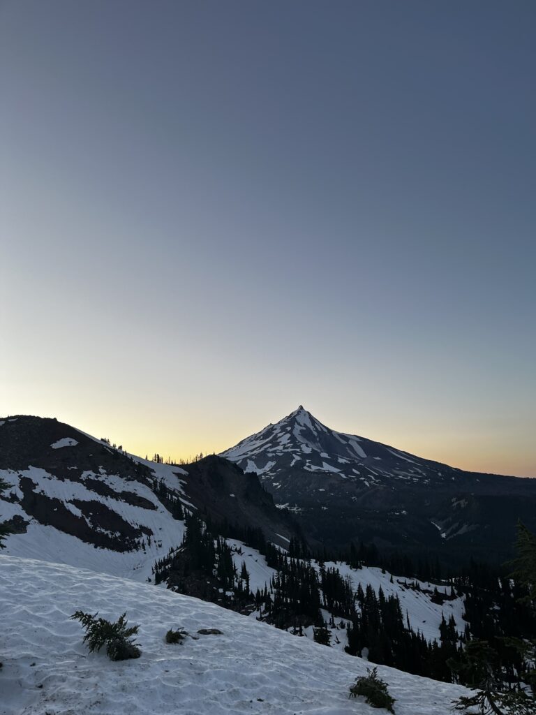
Three Sisters
The Three Sisters area in Oregon is where you hike near three closely spaced volcanic peaks. It’s pretty spectacular. The peaks sit around 10,000 ft, just over 3 km, so you’re hiking naturally closer to them. Some people might try to summit, but not with the amount of snow we had. Still, it was a nice change of scenery, and I was really looking forward to it.
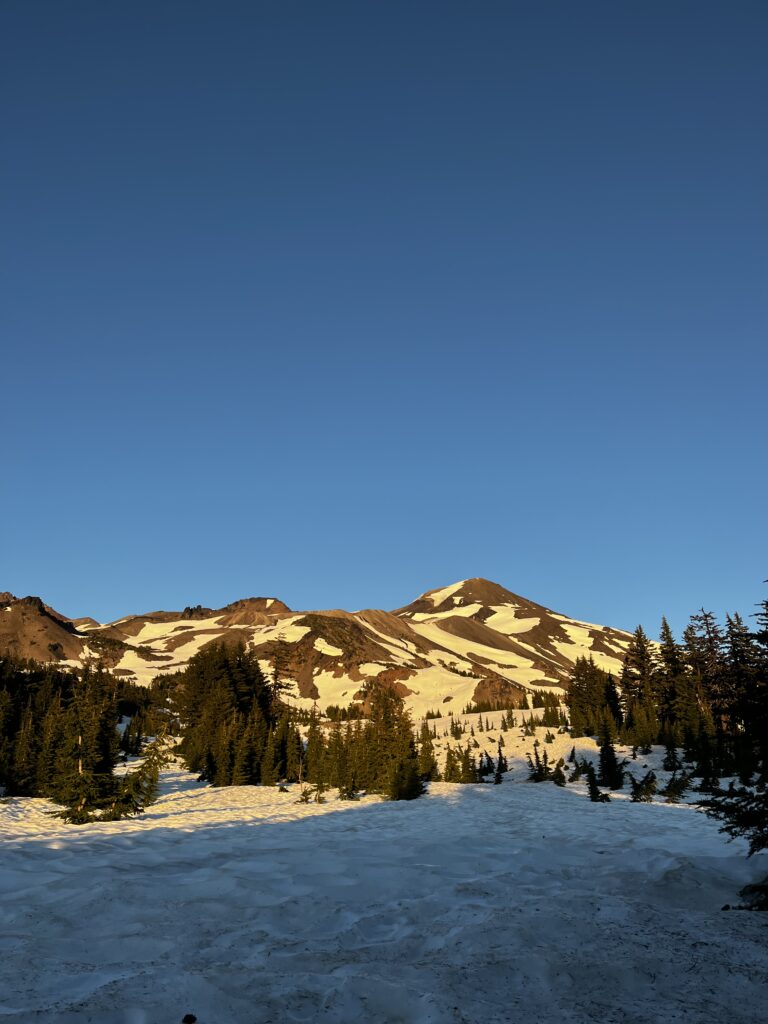
Of course, that meant again hiking on the snow
Big Lake Youth Camp
When I was pitching my tent in the snow, I heard some rumbling and realized someone else was there too. It actually turned out to be a guy I’d met earlier on the Forester Pass at the very start of the year. It was nice to see a familiar face. We decided to hike together for a few days, and the next day we reached a place called Big Lake Youth Camp. It’s basically a Christian-based summer camp, the kind you imagine from the movies—kids running around, doing activities, even jet skis outside. The cool part? They allow hikers to stay for the day: shower, do laundry, charge your gear, maybe grab some snacks, and then move along.
But the best part? They make way too much food. After the kids had eaten, you could eat as much as you wanted. And we absolutely took advantage of that—ripping through tomato soup and grilled cheese sandwiches like never before. I probably had five sandwiches and three bowls of soup, which might be a personal record for me when it comes to tomato soup and grilled cheese.
Getting to Big Lake Youth Camp isn’t exactly easy. You have to go through a section called the lava rocks—and yeah, it’s exactly what it sounds like. You’re hiking over old volcanic terrain, fully exposed, with jagged lava rocks underfoot.
That’s what makes it tough. My feet were swelling and overheating so fast that I had to stop multiple times whenever I saw a tree, just to cool them off and take my shoes off. I could feel blister city coming on if I didn’t give them a break. It’s funny, just a day or two ago, I was hiking on snow for a couple of hours, and now suddenly my feet are burning from the heat of the lava rocks. The trail really keeps you on your toes.
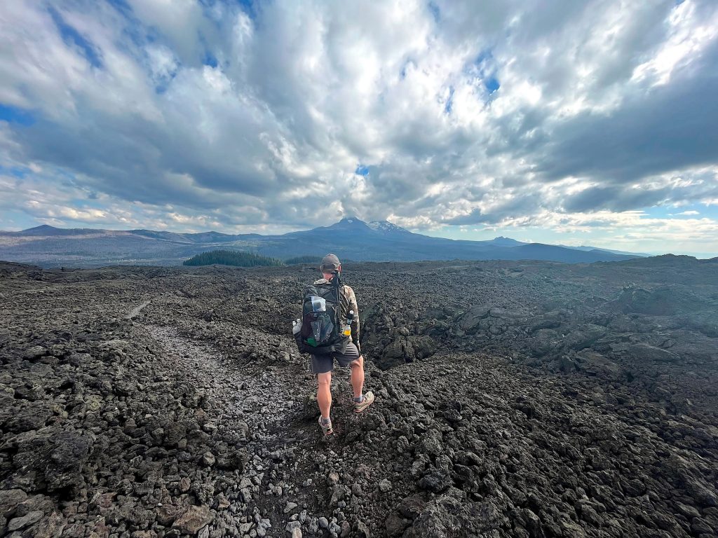
I didn’t have any of my pictures relating to lava rocks because I hated it so much and just wanted to go through them as quickly as possible, so this one is from PCTA
Calories and distance
And just like that, I hit 2,000 miles on the Pacific Crest Trail. That felt good. I mean, 1,800 miles didn’t really feel like a milestone, but 2,000 miles, that’s a nice, round number. At that point, I checked my averages, and yeah… I’d been hitting around 50 kilometers every day for the past month, even with town stops for rest, resupply, showers, and just chilling along the way.
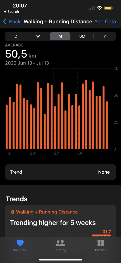
At the same time, in Oregon, I had to do a resupply and send 4 boxes ahead for Washington. Looking back, maybe I could’ve survived with three, but I was being a cheap bum. There was a good Dollar General, so I decided to buy pretty much all the food I’d been eating. And I was eating a lot, upwards of 5,000 calories a day back then. I was moving over 50 kilometers daily, so my body needed it. At least I was eating right… well, eating a lot, anyway. Sure, this food had almost no nutritional value, just pure calories, but I had to keep going. That’s how my resupply cart ended up looking.

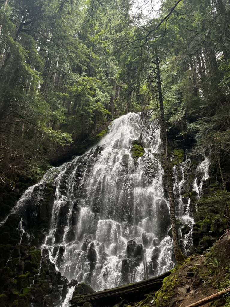
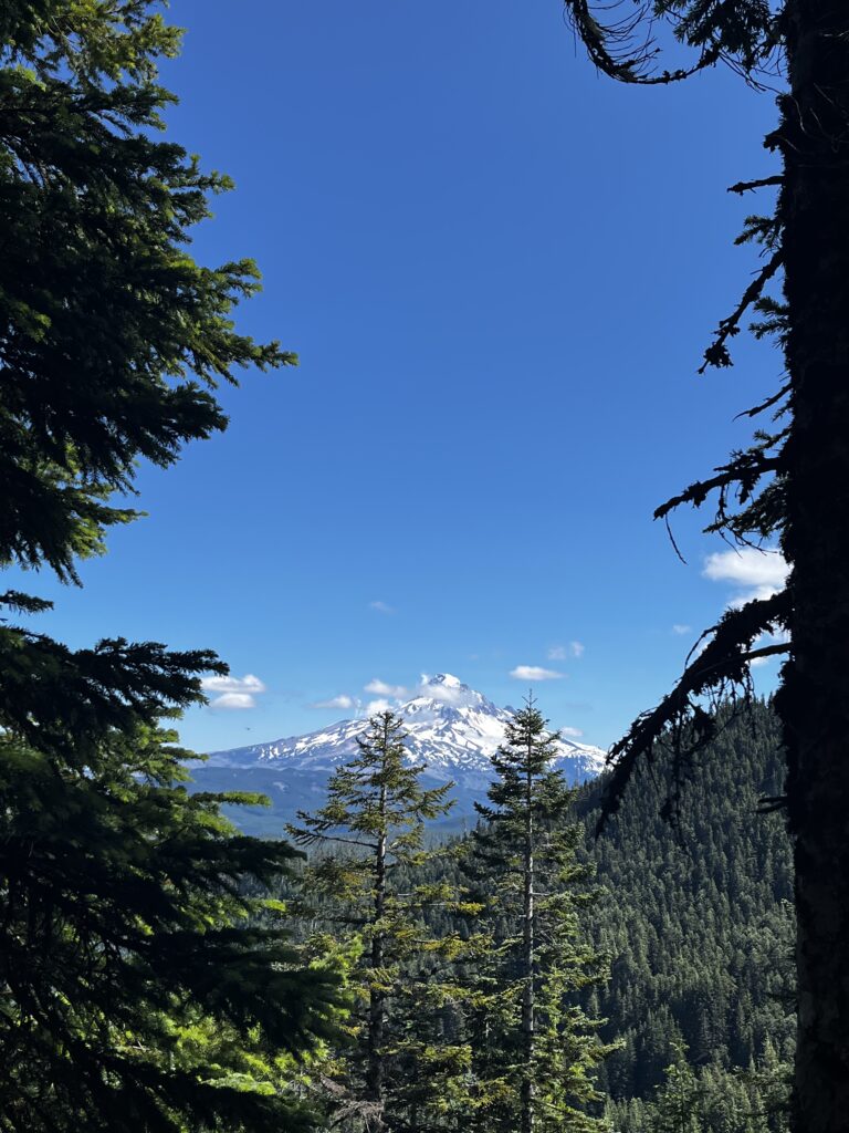
And some more random shots from Oregon
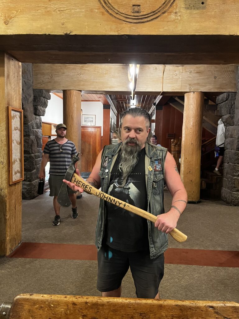
Timberline Lodge
Timberline Lodge is a famous stop for hikers, first of all, because it has a buffet. Unlimited food, and the goal is never to miss it. Naturally, you want to arrive hungry. Don’t forget to check the hiker boxes in the lodge too, people leave some pretty good stuff since there’s a lot of tourism. Then it’s time to eat as much as possible, which is exactly what we did. Funny enough, as through-hikers, we were even offered free beverages. So thanks, Timberline Lodge.
And on top of that, Timberline Lodge is where The Shining was filmed. You can actually see the infamous or famous (depending on how you look at it) axe.
I found a pretty solid camping spot just a few hours after the Timberline Lodge, of course, I gave some time for digestion after that buffet.
Stats
So yeah, even though Oregon fell fast, it was relatively fast. We were still doing some sort of elevation, and these are the numbers for the state. There is this thing called the Oregon Challenge as well, where you try to rip it in 14 days. For me, it was 14.5 days. I could have done it easily in 14 days if I wanted to, but at this point, I knew I was ahead of schedule, so I could just slow down.
Oregon Totals: Distance: 455 miles (733 km) Time: 15 days Elevation Gain: 74,730 ft (22,785 m)
Oregon Daily Averages: Distance: 30.35 miles (48.84 km) Elevation Gain: 4,982 ft (1,519 m)